

The DOI matches its Crossref record.
A Distributed Spatial Method for Modeling Maritime Routes
Open accessAbstract
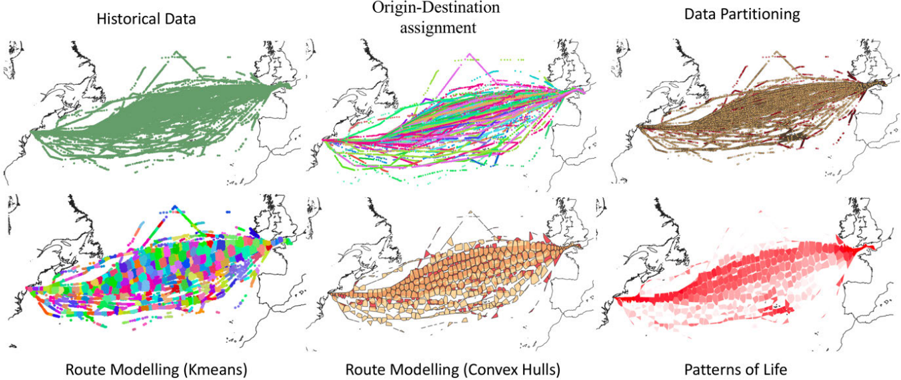
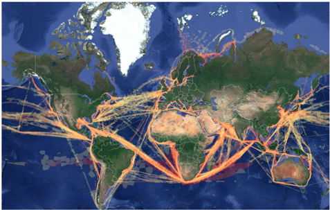
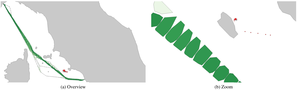
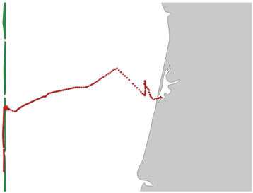
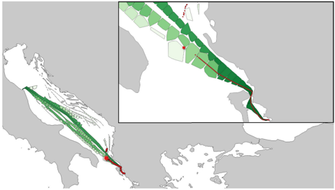
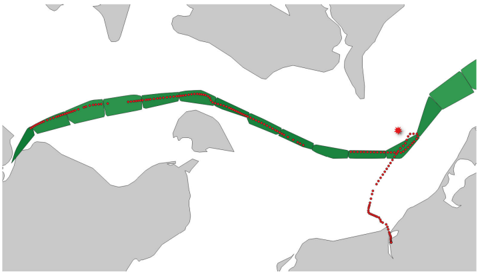
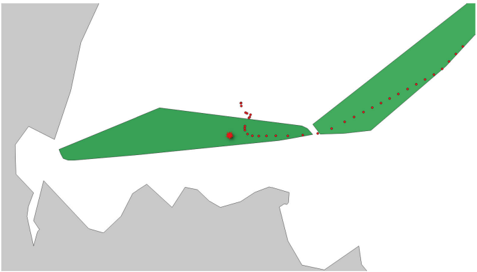
In this work we propose a novel spatial knowledge discovery pipeline capable of automatically unravelling the “roads of the sea” and maritime traffic patterns by analysing voluminous vessel tracking data, as collected through the Automatic Identification System (AIS). We present a computationally efficient and highly accurate solution, based on a MapReduce approach and unsupervised learning methods, capable of identifying the spatiotemporal dynamics of ship routes and most crucially their characteristics, thus deriving maritime “patterns of life” at a global scale, without the reliance on any additional information sources or a priori expert knowledge. Experimental results confirm high accuracy of results and superior performance in comparison to other methods, with the entire processing duration completing in less than 3 hours for more than a terabyte of non-uniform spatial data. Finally, to clearly demonstrate the applicability and impact of our proposed method, we evaluate its ability to detect real world “anomalies”, such as maritime incidents reported in the European Marine Casualty Information Platform. Numerical results show the advantages of our scheme in terms of accuracy, with an achieved anomaly detection accuracy of higher than 93%, by detecting 313 out of 335 relevant maritime incidents.
Overview
The claims and statistics of this paper haven’t been checked yet.
Run the check — free, no account needed. It reads the open-access text and checks the sources it cites.
Integrity signals
Registry
Cites
Statistics
Figures





Verification
Claims the paper makes
The claims and statistics of this paper haven’t been checked yet.
Run the check — free, no account needed. It reads the open-access text and checks the sources it cites.
Claims other papers make about this one
Each is checked against this paper’s own text: does it say what the citing paper says it does?
The cited source says what the claim attributes to it.
In the citing paper
“Knowledge discovery of maritime traffic patterns from AIS data can be broadly classified [10], [11] into statistics-grid-, and vector-based methods.”
From Space-Based Global Maritime Surveillance. Part II: Artificial Intelligence and Data Fusion Techniques (2021) · cites this paper as [11]
Self-check
Percentages, sums and reported differences re-computed from the paper’s own numbers.
The self-check needs the paper’s full text.
Citations
Cites
Still being checked.
Research works printed but not linked: 43
- 10.1016/0304-3975(85)90224-5 · DOI
- 10.1109/TIT.1982.1056489 · DOI · Paper page
- macleod, 2015, Operational analysis at combined maritime forces, Proc 32nd Int Symp Mil Oper Res, 1
- fayyad, 1996, Advances in Knowledge Discovery and Data Mining
- 2013, Methodology for Assessing the Marine Navigational Safety & Emergency Response Risks of Offshore Renewable Energy Installations
- 10.1017/S0373463316000606 · DOI
- dean, 2004, Mapreduce: Simplified data processing on large clusters, Proc OSDI, 137
- 10.1017/S0373463314000253 · DOI
- 2018, Accident Investigation—EMSA—European Maritime Safety Agency
- 2018, World port index
- 10.1017/S0373463310000135 · DOI
- 10.1016/j.trpro.2014.10.051 · DOI
- 10.1111/j.1467-8659.2009.01440.x · DOI
- 10.1109/BigData.2016.7840765 · DOI · Paper page
- 10.1016/j.tre.2017.07.011 · DOI
- 10.3141/2426-05 · DOI
- 10.1109/TITS.2017.2789279 · DOI
- 10.1109/ICIF.2006.301661 · DOI
- laxhammar, 2008, Anomaly detection for sea surveillance, Proc 11th Inter Conf Info Fusion, 1
- ristic, 2008, Statistical analysis of motion patterns in AIS data: Anomaly detection and motion prediction, Proc 11th Inter Conf Info Fusion, 1
- 10.1017/S0373463316000345 · DOI
- 10.1109/TAES.2018.2808098 · DOI · Paper page
- 2018, Solas Chapter V—Regulation 19—Carriage Requirements for Shipborne Navigational Systems and Equipment
- 10.1016/j.oceaneng.2018.02.060 · DOI
- 2018, M 1371 Technical characteristics for an automatic identification system using time-division multiple access in the VHF maritime mobile band
- 10.2478/v10047-012-0015-3 · DOI
- 10.1109/TAES.2016.150596 · DOI · Paper page
- 10.1109/TITS.2017.2724551 · DOI
- 10.1109/DSAA.2018.00044 · DOI · Paper page
- 10.1109/TrustCom.2012.109 · DOI
- ducruet, 2018, Advances Shipping Data Anal Modeling Tracking Mapping Maritime Flows Age Big Data
- 10.1016/j.envsoft.2014.09.009 · DOI
- 2014, Review of Maritime Transport 2014
- 10.3390/e15062218 · DOI
- 10.1109/ACSAT.2013.49 · DOI
- 10.1109/ACCESS.2019.2935794 · DOI
- 2013, Published Maritime Casualty Investigation Reports
- 10.1109/WCSP.2016.7752733 · DOI
- 2018, Maritime History Costa Concordia Disaster
- 10.1109/ICTIS.2019.8883596 · DOI
- 10.1109/SDF.2015.7347707 · DOI
- 2018, Near Miss Accident in Kiel Canal Caused by Navigational Rules Violation
- 10.1016/j.enavi.2016.12.004 · DOI
Cited by
Sorted by citations
Soldi, G., Gaglione, D., Forti, N., Millefiori, L. M., Braca, P., Carniel, S., Simone, A. D., Iodice, A., Riccio, D., Daffina, F. C., et al. (2021) · IEEE Aerospace and Electronic Systems Magazine · doi:10.1109/maes.2021.3070884 · Cited by 44
“Knowledge discovery of maritime traffic patterns from AIS data can be broadly classified [18], [19] into statistics-, grid-, and vector-based methods.”
Background
Metadata
- Authors
- Zissis, D., Chatzikokolakis, K., Spiliopoulos, G., & Vodas, M.
- Affiliations
- University of the Aegean (GR)
- Venue
- IEEE Access
- Published
- 2020
- Volume
- 8
- Pages
- 47556-47568
- ISSN
- 2169-3536 (ISSN-L)
- OpenAlex
- W3011915942
- Cited by
- 53
- References
- 0
- Citations by year
- 2025: 10 · 2024: 10 · 2023: 11 · 2022: 7 · 2021: 10 · 2020: 5
- FWCI
- 4.80
- Type
- journal article
- Language
- en
- Open access
- gold
- doi.org
- Locations
- IEEE Access (publishedVersion, cc-by)
- DOAJ (DOAJ: Directory of Open Access Journals) (submittedVersion, cc-by-sa)
- Funders
- European Metrology Programme for Innovation and Research (825070, 732310)
- Topics
- Physical Sciences › Engineering › Ocean Engineering › Maritime Navigation and Safety
- Physical Sciences › Computer Science › Information Systems › Data Management and Algorithms
- Physical Sciences › Computer Science › Artificial Intelligence › Anomaly Detection Techniques and Applications
- Keywords
- shipping routes, vessel tracking data, Automatic Identification System, spatiotemporal dynamics, MapReduce, unsupervised learning, maritime safety
About these checks
Registry, retraction, Cites and statistics results are computed, not judged, with one exception: a printed reference that no index lists is read once by a model before it counts as a citation error. Claims are extracted by a model and kept only when their quote appears verbatim in the text; each cited source is then checked, with a model’s help, for whether it says what the claim relies on. Those verdicts can be wrong — read the claim’s quote and the cited source before relying on one.
Statistics and arithmetic are recomputed, not judged.
Confidence bands are shown only for fields calibrated on our annotated test set. None is calibrated yet, so no band is shown.
What counts as a claim ›How we measure confidence ›How we check this ›
Are you an author, or do you see a problem with this page? Request a review
How to cite
Cite CoChat for the checks on this page, and the paper for its own findings.
- This page
- CoChat. (2026). Citation check: A Distributed Spatial Method for Modeling Maritime Routes. https://app.cochat.ai/papers/10.1109/access.2020.2979612
- The paper
- Zissis, D., Chatzikokolakis, K., Spiliopoulos, G., & Vodas, M. (2020). A Distributed Spatial Method for Modeling Maritime Routes. IEEE Access. https://doi.org/10.1109/access.2020.2979612
