

The DOI matches its Crossref record; 8 of the 8 references it cites were found in a registry or an index; none of the 34 sources its claims cite is checked for support yet.
Caminos de frontera: espacio y poder en la historia del piedemonte amazónico colombiano
Open accessAbstract
The research is based on the analysis and contrasting of primary sources such as travelers’ accounts, cartographic representations, and missionary and government archives. Conclusions: By establishing historical continuity in the discourses and infrastructure practices of the Andean-Amazonian foothills, we can conclude that these are part of a long-standing tradition in which the foothills is seen as a frontier, and roads and highways are viewed as “civilizing” infrastructure of the Amazonian space.
Overview
CoChat Summary
TL;DR
The article argues that the colonial and postcolonial vision of the Colombian Andean-Amazonian piedemonte as a physical and symbolic frontier between "civilization" and "savagery" legitimized road-building projects and, through them, the control and appropriation of the Amazon. It traces this discourse from the colonial period through nineteenth-century criollo geography to the Capuchin mission road of 1909–1912, and finds it persisting in present-day infrastructure agendas such as IIRSA.
Key findings
- The piedemonte (approx. 15,000 km²) was configured as a frontier of colonial power: of 28 mission towns established between 1693 and 1750, only seven were still mentioned at the end of that period, and the Franciscans abandoned the piedemonte definitively in the 1780s.
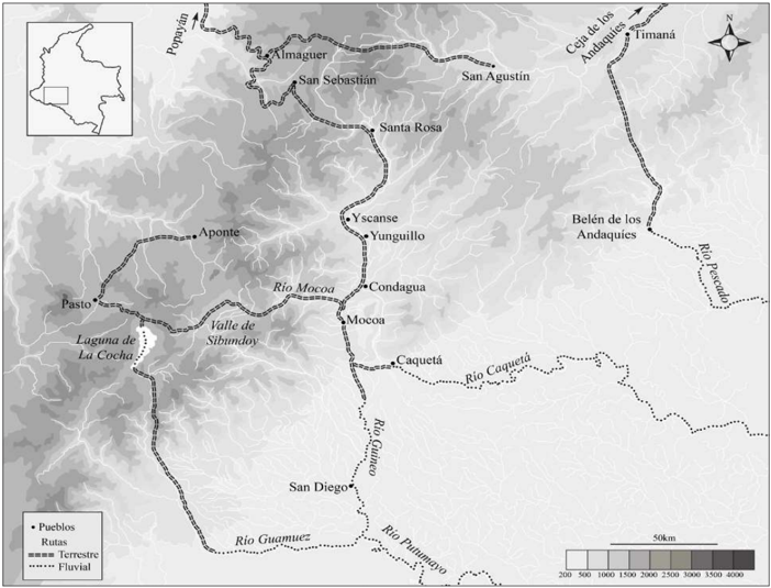
- Indigenous groups did not treat the piedemonte as a barrier but as an articulation zone; four main indigenous routes connected the Andes with the Caquetá and Putumayo river basins, and groups such as the ingas of the Sibundoy valley acted as intermediaries, exchanging Andean products for forest goods throughout the colonial period.
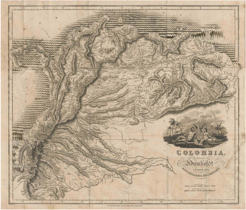
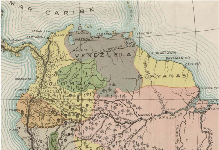
- Nineteenth-century geographers (Caldas, Codazzi, Reyes, Triana) naturalized the piedemonte as a frontier of civilization, portraying the Amazon as "malsano," "desierto" and "salvaje" while simultaneously rich in resources — a rhetoric that legitimized roads, steam navigation and immigration as civilizing forces.
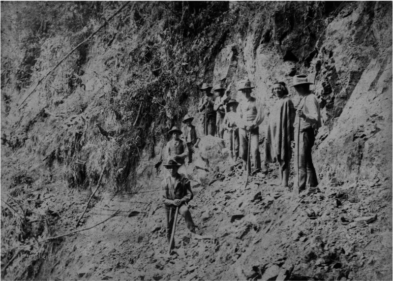
- The Capuchin road (Pasto–Sibundoy–Mocoa, 120 km, built October 1909–March 1912) was funded by a $40,000 government resolution with Fidel de Montclar as "inspector superior"; the final section, with a three-meter-wide bench, reportedly required the permanent labor of nearly 1,500 workers and more than three tons of dynamite. By 1930 the mission claimed 19,700 "colonos civilizados," 6,600 Indians being "reduced to civilized life," 39 towns, 32 churches, 62 schools, two orphanages, a hospital and five dispensaries.
- The road enabled the dispossession of Kamentsá and Ingano lands in the Sibundoy valley (e.g., the 1916 founding of the Sucre/Colón colony), and indigenous labor — including women and children as cargueros carrying 12–30 kg over journeys of up to seven days from Pasto — was used, sometimes under a mission "castigo" regime exempted from a 1909 prohibition on unpaid work.
- The vision persists: IIRSA's Amazon axis reports 24 completed and 46 active projects, and the new Sibundoy–Mocoa "variante San Francisco–Mocoa" largely follows the Capuchin road's route.
Methods
- Historical analysis based on the contrast of primary sources: travel accounts (Triana, Codazzi, Reyes, Santa Gertrudis, López Ruiz), cartographic representations, and missionary and government archives (Archivo General de la Nación, Archivo Provincial Capuchino de Cataluña, Archivo de la Diócesis de Sibundoy).
- The argument is framed through Braudel's *longue durée*, treating the piedemonte-as-frontier vision as a persistent structure rather than a period-specific discourse.
- The text is organized in four parts: colonial representations versus indigenous articulation; nineteenth-century criollo geographic discourse; Capuchin road-building in the early twentieth century; and contemporary infrastructure as evidence of continuity.
Limitations
- Stated: a complete description of the conflicts surrounding the road is "más allá del alcance de este artículo"; and missionary progress reports do not disaggregate indigenous and peasant labor, making it difficult to establish the proportion of each group or what percentage of indigenous workers were paid.
- Evident from the text: the account of the road's social effects relies heavily on missionary, state and elite sources, with indigenous perspectives appearing only through occasional letters and telegrams of complaint; the contemporary IIRSA discussion is brief and based on institutional project reports rather than fieldwork.
Model-written summary. Check it against the paper before relying on it.
Integrity signals
Registry
Cites
Statistics
Figures
Verification
Claims the paper makes
33 Sources not found · 33 Own interpretation · 27 Own result · 6 Not checked yet · 1 Own method · 1 No basis given
In the paper
“No obstante, comenzando con Caldas, y durante las décadas siguientes, se elaboraron diferentes cartas cartográficas generales y provinciales de la República que tuvieron el propósito, entre otros objetivos, de ampliar el conocimiento geográfico del territorio nacional 23 .”
§ Caminos de frontera: espacio y poder en la historia del piedemonte amazónico colombiano • > 2. El piedemonte en el discurso geográfico criollo
What the sources say
- Not matchedcites [23]
Couldn’t be matched to a paper in Crossref, so it can’t be checked.
plain- Asserted: passes — The authors put it forward as true.
- Checkable: passes — It can be checked against evidence.
- Load-bearing: unclear — It is unclear whether the paper’s conclusions depend on it.
- Based: passes — The paper gives a reason why it holds.
- Not matched
A result the paper states — it cites no source for it, so there is none to check. The quote shows it is in the paper.
In the paper
“En el caso de las iniciativas de la misión capuchina, el cambio más dramático tuvo lugar en el valle de Sibundoy, en la parte alta del actual departamento de Putumayo.”
§ Caminos de frontera: espacio y poder en la historia del piedemonte amazónico colombiano • > 2. El piedemonte en el discurso geográfico criollo
plain- Asserted: passes — The authors put it forward as true.
- Checkable: passes — It can be checked against evidence.
- Load-bearing: unclear — It is unclear whether the paper’s conclusions depend on it.
- Based: passes — The paper gives a reason why it holds.
In the paper
“A partir de este momento, y durante casi un siglo, hasta el auge extractivo de quina en la década de 1870, la presencia de colonos e instituciones estatales es muy restringida, limitándose sobre todo a la incursión o el establecimiento esporádico de autoridades gubernamentales, comerciantes y exploradores 11 .”
§ Caminos de frontera: espacio y poder en la historia del piedemonte amazónico colombiano • > 1. La construcción del piedemonte como frontera
What the sources say
- Not matchedcites [11]
Couldn’t be matched to a paper in Crossref, so it can’t be checked.
plain- Asserted: passes — The authors put it forward as true.
- Checkable: passes — It can be checked against evidence.
- Load-bearing: passes — The paper’s conclusions depend on it.
- Based: passes — The paper gives a reason why it holds.
- Not matched
A result the paper states — it cites no source for it, so there is none to check. The quote shows it is in the paper.
In the paper
“Desde los albores de la Independencia, la élite criolla fue muy consciente del reto que imponía a la construcción de un proyecto de estado el escaso o nulo control político sobre una buena parte del territorio nacional.”
§ Caminos de frontera: espacio y poder en la historia del piedemonte amazónico colombiano • > 2. El piedemonte en el discurso geográfico criollo
plain- Asserted: passes — The authors put it forward as true.
- Checkable: passes — It can be checked against evidence.
- Load-bearing: passes — The paper’s conclusions depend on it.
- Based: passes — The paper gives a reason why it holds.
None of the sources cited for this claim have been checked yet.
In the paper
“Los pueblos de misión, varios de los cuales funcionaban simultáneamente como centros de catequización y abastecimiento de mano de obra para las encomiendas mineras, tuvieron una vida efímera, debido a los factores ya mencionados.”
§ Caminos de frontera: espacio y poder en la historia del piedemonte amazónico colombiano • > 1. La construcción del piedemonte como frontera
plainstates a cause- Asserted: passes — The authors put it forward as true.
- Checkable: passes — It can be checked against evidence.
- Load-bearing: unclear — It is unclear whether the paper’s conclusions depend on it.
- Based: passes — The paper gives a reason why it holds.
43 more claims
Create a free account to see all 101 claims and every source verdict.
- It may state two separate claims as one. 42
- Probably not a substantial claim. 25
- The quote only partly states this claim. 2
Self-check
Percentages, sums and reported differences re-computed from the paper’s own numbers.
Each contradiction between two passages listed here was confirmed by an independent check.
Rated minor: it would not touch a result — a value no result rests on, a p-value that stays on the same side of the significance level, or a conflict that is clerical, resolved elsewhere in the paper, or outside its own findings.
In the paper
§ Caminos de frontera: espacio y poder en la historia del piedemonte amazónico colombiano • > 1. La construcción del piedemonte como frontera
“Augusto Gómez, "Bienes, rutas y mercados (siglos XV-XIX).Las relaciones de intercambio entre las tierras bajas de la Amazonia y las tierras altas de los Andes".Revista de Antropología y Arqueología IX, n.° 1-2 (1997): 47-76”
§ Caminos de frontera: espacio y poder en la historia del piedemonte amazónico colombiano • > References
“Gómez, Augusto. "Bienes, rutas y mercados (siglos XV-XIX). Las relaciones de intercambio entre las tierras bajas de la Amazonia y las tierras altas de los Andes". Revista de Antropología y Arqueo- logía IX, n.° 1-2 (1996): 51-80.”
Rated minor: it would not touch a result — a value no result rests on, a p-value that stays on the same side of the significance level, or a conflict that is clerical, resolved elsewhere in the paper, or outside its own findings.
In the paper
§ Caminos de frontera: espacio y poder en la historia del piedemonte amazónico colombiano • > Conclusión
“En diciembre de 2005, en el contexto de una visita oficial a Colombia del presidente brasilero Luiz Inácio Lula da Silva, el presidente colombiano Álvaro Uribe pronunció un discurso en su honor”
§ Caminos de frontera: espacio y poder en la historia del piedemonte amazónico colombiano • > References
“"Discurso del presidente Uribe durante almuerzo en honor de su homólogo de Brasil, Luiz Inácio Lula da Silva", Bogotá, 14 diciembre 2015”
Citations
Cites
Mapping the Country of Regions
Appelbaum, N. P. (2016) · University of North Carolina Press eBooks · doi:10.5149/northcarolina/9781469627441.001.0001 · Cited by 174
Uribe, S. (2017) · Wiley eBooks · doi:10.1002/9781119100218 · Cited by 71
Self-citationIllegible infrastructures: Road building and the making of state-spaces in the Colombian Amazon
Uribe, S. (2018) · Environment and Planning D Society and Space · doi:10.1177/0263775818788358 · Cited by 49
Self-citationFiebre de tierra caliente. Una historia ambiental de Colombia 1850-1930
Castañeda, P., & German, A. A. (2006) · Repositorio Institucional UN - Biblioteca Digital · Cited by 39
History and the Social Sciences: The Long Duration
Braudel, F. (1960) · Political Research Organization and Design · doi:10.1177/000276426000300601 · Cited by 38
Steele, A. R. (1957) · Hispanic American Historical Review · doi:10.1215/00182168-37.4.532b · Cited by 30
Siervos de Dios y Amos de los Indios
Bonilla, V. D. (2006) · Universidad del Cauca eBooks · doi:10.2307/j.ctvpv50vr · Cited by 28
Red Rubber, Bleeding Trees: Violence, Slavery, and Empire in Northwest Amazonia, 1850-1933
Hill, J. D. (1999) · Hispanic American Historical Review · doi:10.1215/00182168-79.4.779 · Cited by 2
Research works printed but not linked: 4
- Gómez, Augusto. “Bienes, rutas y mercados (siglos XV-XIX). Las relaciones de intercambio entre las tierras bajas de la Amazonia y las tierras altas de los Andes”. Revista de Antropología y Arqueología IX, n.° 1-2 (1996): 51-80.
- Llanos, Héctor y Jorge Alarcón. “Por los caminos del Alto Caquetá”. Boletín de Arqueología 15, n.° 1 (2000): 3-59.
- Pineda, Roberto. “Panorama de la historia económica de la Amazonia (siglos XVII-XIX)”. Boletín de Antropología 6, n.° 21 (1987): 63-85.
- Uribe, María Victoria. “Pastos y protopastos: la red regional de intercambio de productos y materias primas de los siglos X a XVI D.C.”. Revista Maguaré 3 (1986): 33-43.
Cited by
Uribe, S. (2021) · Antípoda Revista de Antropología y Arqueología · doi:10.7440/antipoda42.2021.09 · Cited by 13
Self-citation‘Tradescapes’ in the forest: framing infrastructure’s relation to territory, commodities, and flows
Marimón, P. D., Bebbington, D. H., Bebbington, A., Sauls, L. A., Cuba, N., Chicchón, A., Hecht, S. B., Rogan, J. S., Ray, R., Diaz, O., et al. (2021) · Current Opinion in Environmental Sustainability · doi:10.1016/j.cosust.2021.10.004 · Cited by 7
Tovar, J. G., Jacanamejoy, K. B., Ríos, V. L., Jacanamejoy, J. R. B., Mutumbajoy, N. E., Huasna, D. O., Peralta, P. A., Buschbacher, R., & Perz, S. G. (2025) · Sustainability · doi:10.3390/su17209122 · Cited by 1
Gómez, L. M. G. (2021) · Historia Crítica · doi:10.7440/histcrit82.2021.06 · Cited by 1
Conectividad de las áreas protegidas a través del paisaje del departamento de Caquetá
Moyano-Molano, A. L., & Quintero, L. L. R. (2020)
Metadata
- Authors
- Uribe, S.
- Affiliations
- Universidad del Rosario (CO)
- Corresponding author
- Uribe, Simón
- ORCID
- Uribe, Simón
- Venue
- Historia Crítica
- Publisher
- Universidad de los Andes
- Published
- 2019-04-01
- Issue
- 72
- Pages
- 69-92
- ISSN
- 0121-1617 (ISSN-L)
- 1900-6152
- OpenAlex
- W2929146880
- Cited by
- 5
- References
- 7
- Citations by year
- 2025: 1 · 2021: 3 · 2020: 1
- FWCI
- 14.75
- Type
- journal article
- Language
- en
- Open access
- diamond
- doi.org
- Licence
- Locations
- Historia Crítica (publishedVersion, cc-by-nc-nd)
- LA Referencia (Red Federada de Repositorios Institucionales de Publicaciones Científicas) (submittedVersion, cc-by-nc-nd)
- OpenEdition (OpenEdition) (submittedVersion, cc-by-nc-nd)
- LA Referencia (Red Federada de Repositorios Institucionales de Publicaciones Científicas) (submittedVersion, other-oa)
- DOAJ (DOAJ: Directory of Open Access Journals) (submittedVersion, cc-by-sa)
- Redalyc (Universidad Autónoma del Estado de México) (submittedVersion)
- Topics
- Social Sciences › Arts and Humanities › History › History and Politics in Latin America
- Social Sciences › Anthropology › Indigenous Cultures and History
- Social Sciences › Arts and Humanities › History › Historical Studies in Latin America
- Keywords
- colonial frontier, transport infrastructure, roads and highways, civilizing mission, state building, colonial cartography, travelers' accounts, missionary archives, Amazonian region, southern Colombia, space and power
About these checks
Registry, retraction, Cites and statistics results are computed, not judged, with one exception: a printed reference that no index lists is read once by a model before it counts as a citation error. Claims are extracted by a model and kept only when their quote appears verbatim in the text; each cited source is then checked, with a model’s help, for whether it says what the claim relies on. Those verdicts can be wrong — read the claim’s quote and the cited source before relying on one.
A language model drew the claims from the paper on 2026-11-10, under version 3 of the claim definition (model deepseek-v4.1-flash, prompt extract-v3).
A second model labelled each claim on 2026-11-10 (model jev-1.13-20260917, definition revision gold-guideline-v0.2).
Statistics and arithmetic are recomputed, not judged.
Confidence bands are shown only for fields calibrated on our annotated test set. None is calibrated yet, so no band is shown.
What counts as a claim ›How we measure confidence ›How we check this ›
Are you an author, or do you see a problem with this page? Request a review
Data sources
Bibliographic data: Semantic Scholar, OpenAlex, Crossref.
Contains information from the Semantic Scholar Academic Graph Datasets, made available under the ODC Attribution License (ODC-BY 1.0).
Semantic Scholar’s data is described in: Kinney, R., et al. (2023). The Semantic Scholar Open Data Platform. arXiv:2301.10140.
