

The DOI matches its Crossref record; 3 of the 3 references it cites were found in a registry or an index.
Multidisciplinary digital methodologies for documentation and preservation of immovable Archaeological heritage in the Khovd River Valley, Western Mongolia
Abstract
Background: The archaeological and ethnographic heritages of Mongolia reflect a multi-millennial continuity of typically mobile-pastoral occupations across sparsely populated, environmentally diverse landscapes, but the threats of modernisation and industrialisation to those heritages are nevertheless present and substantial. The construction of the Erdeneburen Hydroelectric Dam on the Khovd River in western Mongolia is planned to submerge hundreds of archaeological features and jeopardise at least another thousand. Methods: The Mongolian Archaeology Project: Surveying the Steppes, in collaboration with the Mongolian Institute of Archaeology, integrates a variety of digital techniques including GIS (geographic information systems), Machine Learning automated site detection, drone mapping, and Structure-from-Motion LiDAR scanning to document the endangered archaeology. This paper presents the resulting dataset of archaeological features across three different impact zones associated with the dam construction and evaluates the degree of efficacy of the initial data integration strategy through informal partner feedback and self-assessment. Results: While only approximately 20% of the documented sites fall within the planned flood zone, the remaining sites will be subjected to collateral threats such as industrial and infrastructural development that will necessitate extended monitoring, both temporally and spatially. In consideration of these results, this paper argues that a ‘responsive’ mode of heritage disaster intervention can bridge the gap between ‘reactive’ and ‘proactive’ modes, but requires development of an integrated (digital) methodology. Conclusions : The paper concludes by offering a new, more interconnected ‘transmethodology’ that addresses spatiality, sub-sampling, data reuse, and community input across multiple disciplines such as cultural heritage preservation, salvage archaeology, computer vision, and community archaeology. The authors developed this ‘transmethodology’ and the resulting workflows out of a theoretical framework that considers principles of Symmetrical Archaeology, Resilience Humanitarianism, and the CARE standard for inclusive data management (Collective benefit, Authority to control, Responsibility, and Ethics).
Overview
The claims and statistics of this paper haven’t been checked yet.
Run the check — free, no account needed. It reads the open-access text and checks the sources it cites.
Integrity signals
Registry
Cites
Statistics
Figures

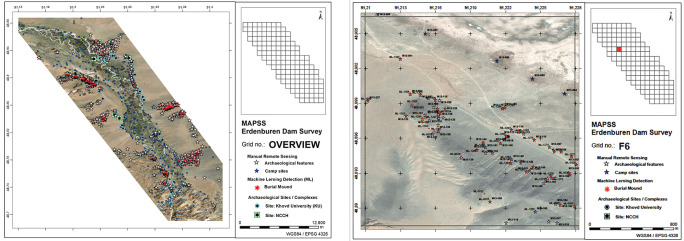
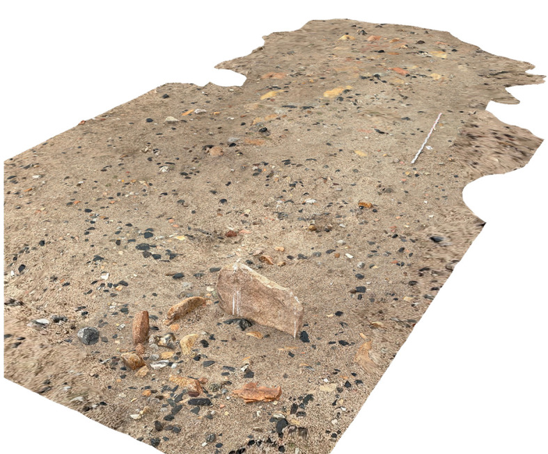
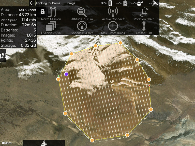
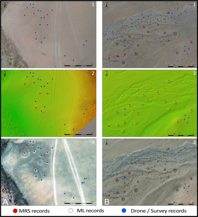
Verification
Claims the paper makes
The claims and statistics of this paper haven’t been checked yet.
Run the check — free, no account needed. It reads the open-access text and checks the sources it cites.
Claims other papers make about this one
Each is checked against this paper’s own text: does it say what the citing paper says it does?
In the citing paper
“Mask R-CNN has demonstrated its effectiveness in similar archaeological contexts34, including the detection of burial clusters across the Mongolian steppe35, burials36 and charcoal hearth sites37 in Germany, as well as terraces in Samoa38.”
From Multiscale anthropogenic feature detection in the argentinian andes: satellite machine learning, UAV, and pedestrian survey (2026) · cites this paper as [35]
Self-check
Percentages, sums and reported differences re-computed from the paper’s own numbers.
The self-check needs the paper’s full text.
Citations
Cites
Faster R-CNN: Towards Real-Time Object Detection with Region Proposal Networks
Ren, S., He, K., Girshick, R., & Sun, J. (2017) · IEEE Transactions on Pattern Analysis and Machine Intelligence · doi:10.1109/tpami.2016.2577031 · Cited by 73,472
The FAIR Guiding Principles for scientific data management and stewardship
Wilkinson, M. D., Dumontier, M., Aalbersberg, I. J., Appleton, G., Axton, M., Baak, A., Blomberg, N., Boiten, J.-W., da Silva Santos, L. B., Bourne, P. E., et al. (2016) · Scientific Data · doi:10.1038/sdata.2016.18 · Cited by 18,423 · cited 1×
“The FAIR principles state that data should be Findable, Accessible, Interoperable, and Reusable (Wilkinson et al. 2016; Letellier et al. 2007; Quintero et al. 2020).”
BackgroundReview of Deep Learning Algorithms and Architectures
Shrestha, A., & Mahmood, A. (2019) · IEEE Access · doi:10.1109/access.2019.2912200 · Cited by 1,883 · cited 2×
“…of typically four layers that first sort pixel values (input layer), then filter pixels to identify edges (convolutional layer), then pool values (pooling layer), and finally connect all layers and assign a unique value to each object (fully-connected layer; Shrestha & Mahmood 2019: 53044).”
Background
Research works printed but not linked: 50
- M Alhasanat, 2021, RetinaNet-based Approach for Object Detection and DistanceEstimation in an Image., International Journal on Communications Antenna and Propagation (IRECAP)., 11, 1-9, 10.15866/irecap.v11i1.19341 · DOI
- C Barton, 2017, Cultural-heritage inventory implementations: the versatility of the Arches system., APT Bulletin: The Journal of Preservation Technology., 48, 19-28
- A Bevan, 2015, The Data Deluge., Antiquity., 89, 1473-1484, 10.15184/aqy.2015.102 · DOI
- C Breen, 2022, Documenting, Protecting and Managing Endangered Maritime Cultural Heritage in the Middle East and North Africa (MENA) Region., J. Marit. Archaeol., 10.1007/s11457-022-09338-z · DOI
- J Casana, 2017, Satellite Imagery-based Monitoring of Archaeological Site Damage in the Syrian Civil War., PLoS One., 12, e0188589, 10.1371/journal.pone.0188589 · DOI · Paper page
- J Casana, 2014, Satellite-Based Monitoring of Looting and Damage to Archaeological Sites in Syria., Journal of Eastern Mediterranean Archaeology and Heritage Studies., 2, 128-151, 10.5325/jeasmedarcherstu.2.2.0128 · DOI
- L Casini, 2021, The Barrier of Meaning in Archaeological Data Science. Proceedings SCIFI-IT'2020-4th Annual Science Fiction Prototyping Conference, Ghent, Eurosis., 61-65
- D Cui, 2019, Spatiotemporal Evolution and the Driving Forces of the Coupling Coordination Degree between Urbanization and Urban Residents’ Livelihood Level in Mongolia., Sustainability., 11, 1-22, 10.3390/su11030781 · DOI
- M Clarke, 2015, The Digital Dilemma: Preservation and the Digital Archaeological Record., Advances in Archaeological Practice., 3, 313-330, 10.7183/2326-3768.3.4.313 · DOI
- A Ekblom, 2019, Conservation through Biocultural Heritage—Examples from Sub-Saharan Africa., Land., 8, 5, 10.3390/land8010005 · DOI
- M Fisher, In press, Stability of Cultural Information in Unstable Environments: Data Management for Immovable Cultural Heritage in Times of Disaster. Routledge Handbook for Cultural Heritage Preservation in Times of Disaster, B. Rouhani & X. Romão, eds. Accepted 3 May, 2022.
- M Fisher, 2021, Ethical Considerations for Remote Sensing and Open Data in Relation to the Endangered Archaeology in the Middle East and North Africa Project., Archaeological Prospection., 28, 279-292, 10.1002/arp.1816 · DOI
- M Fradley, 2017, Satellite Imagery and Heritage Damage in Egypt: A Response to ‘Satellite Evidence of Archaeological Site Looting in Egypt: 2002–2013’ (Parcak et al. 2016)., Antiquity: A Quarterly Review of Archaeology., 91, 784-792, 10.15184/aqy.2017.25 · DOI
- A Green, 2019, Re-Discovering Ancient Landscapes: Archaeological Survey of Mound Features from Historical Maps in Northwest India and Implications for Investigating the Large-Scale Distribution of Cultural Heritage Sites in South Asia., Remote Sensing., 11, 1-26, 10.3390/rs11182089 · DOI
- D Hadjimitsis, 2009, Monitoring Archaeological Site Landscapes in Cyprus Using Multi-Temporal Atmospheric Corrected Image Data., International Journal of Architectural Computing., 7, 121-138, 10.1260/147807709788549376 · DOI
- E Hammer, 2018, Remote Assessments of the Archaeological Heritage Situation in Afghanistan., Journal of Cultural Heritage., 33, 125-144, 10.1016/j.culher.2017.12.008 · DOI
- D Hilhorst, 2018, Classical Humanitarianism and Resilience Humanitarianism: Making Sense of Two Brands of Humanitarian Action., Journal of International Humanitarian Action., 3, 10.1186/s41018-018-0043-6 · DOI · Paper page
- W Honeychurch, 2010, Pastoral Nomadic Voices: A Mongolian Archaeology for the Future., World Archaeology., 42, 405-417, 10.1080/00438243.2010.497389 · DOI
- J Houle, 2016, Long-Term Occupation and Seasonal Mobility in Mongolia: A Comparative Study of Two Mobile Pastoralist Communities. Fitful Histories and Unruly Publics: Rethinking Temporality and Community in Eurasian Archaeology., 155-174, 10.1163/9789004325470_008 · DOI
- C Hritz, 2010, Tracing Settlement Pattern and Channel Systems in Southern Mesopotamia Using Remote Sensing., Journal of Field Archaeology., 35, 184-203, 10.1179/009346910X12707321520477 · DOI
- J Huggett, 2015, Challenging Digital Archaeology., Open Archaeology., 1, 79-85, 10.1515/opar-2015-0003 · DOI
- J Huggett, 2017, The Apparatus of Digital Archaeology., Internet Archaeology., 44, 10.11141/ia.44.7 · DOI
- R Jigyasu, 2019, Managing Cultural Heritage in the Face of Climate Change., Journal of International Affairs., 73, 87-100
- I Khwaja, 2021, Transmethodology: Creating spaces for transgressive and transformative inquiry., Outlines - Critical Practice Studies., 22, 1-21
- W Liu, 2015, SSD: Single Shot MultiBox Detector. arXiv:1512.02325. · arXiv
- D Lukas, 2018, Towards a Living Archive: Making Multi Layered Research Data and Knowledge Generation Transparent., Journal of Field Archaeology., 43, S19-S30, 10.1080/00934690.2018.1516110 · DOI
- L Luo, 2019, Airborne and Spaceborne Remote Sensing for Archaeological and Cultural Heritage Applications: A Review of the Century (1907–2017)., Remote Sensing of Environment., 232, 1-34, 10.1016/j.rse.2019.111280 · DOI
- K MacFarland, 2016, Dusting Off the Data: Curating and Rehabilitating Archaeological Legacy and Orphaned Collections., Advances in Archaeological Practice., 4, 161-175, 10.7183/2326-3768.4.2.161 · DOI
- D Meyers, 2016, Heritage Inventories: Promoting Effectiveness as a vital tool for Sustainable Heritage Management., Journal of Cultural Heritage Management and Sustainable Development., 6, 102-112, 10.1108/JCHMSD-02-2016-0009 · DOI
- S Parcak, 2007, Satellite Remote Sensing Methods for Monitoring Archaeological Tells in the Middle East., Journal of Field Archaeology., 32, 65-81, 10.1179/009346907791071773 · DOI
- S Parcak, 2016, Satellite Evidence of Archaeological Site Looting in Egypt: 2002–2013., Antiquity., 90, 188-205, 10.15184/aqy.2016.1 · DOI
- S Quintero, 2020, Harnessing digital workflows for the understanding, promotion and participation in the conservation of heritage sites by meeting both ethical and technical challenges., Built Heritage., 4, 10.1186/s43238-020-00005-7 · DOI
- J Redmon, 2018, YOLOv3: An Incremental Improvement., Tech Report, Computer Vision and Pattern Recognition., 2-3, 10.48550/arXiv.184.02767 · DOI
- C Reichel, 2005, Beyond Cataloguing Losses: The Iraq Museum Database Project at the Oriental Institute, University of Chicago., Visual Resources., XXI, 93-113
- H Richards-Rissetto, 2019, Digitally-Mediated Practices of Geospatial Archaeological Data: Transformation, Integration, & Interpretation., Journal of Computer Applications in Archaeology., 2, 120-135, 10.5334/jcaa.30 · DOI
- L Rouse, 2020, On the Fly: Strategies for UAV-based Archaeological Survey in Mountainous Areas of Central Asia and their Implications for Landscape Research., Journal of Archaeological Science: Reports., 30, 1-14
- C Scott, Born-Digital Logistics: Impacts of 3D Recording on Archaeological Workflow, Training, and Interpretation., Open Archaeology., 7, 574-588, 10.1515/opar-2020-0150 · DOI
- M Shanks, 2007, Symmetrical Archaeology., World Archaeology., 39, 589-596, 10.1080/00438240701679676 · DOI
- L ten Harkel, 2021, The EAMENA Database and Its Potential Impact on Research and Heritage Management: A Case Study of Crusader Heritage in Lebanon., Levant., 53, 282-301, 10.1080/00758914.2021.1988474 · DOI
- S Tews, 2022, From the Coast to the High Mountains: A Remote Sensing Survey of Disturbances and Threats to the Archaeology and Heritage of South Sinai., Journal of Maritime Archaeology., 10.1007/s11457-022-09335-2 · DOI
- J Ur, 2006, Google Earth and Archaeology., The SAA Archaeological Record., 6, 35-38
- P VanValkenburgh, 2020, Big Archaeology: Horizons and Blindspots., Journal of Field Archaeology., 45, S1-S7, 10.1080/00934690.2020.1714307 · DOI · Paper page
- K Westley, 2021, Climate Change and Coastal Archaeology in the Middle East and North Africa: Assessing Past Impacts and Future Threats., The Journal of Island Coastal Archaeology., 1-33, 10.1080/15564894.2021.1955778 · DOI
- K Wilkinson, 2006, Satellite imagery as a resource in the prospection for archaeological sites in central Syria., Geoarchaeology., 21, 735-750, 10.1002/gea.20136 · DOI
- T Williams, 2016, Silk Roads in the Kingdom of Bhutan and the Development of a National Heritage Inventory., Archaeology International., 19, 122-133, 10.5334/ai.1918 · DOI
- R Witcher, 2008, (Re) surveying Mediterranean Rural Landscapes: GIS and Legacy Survey Data., Internet Archaeology., 24, 10.11141/ia.24.2 · DOI
- J Wright, 2016, Households without Houses., Journal of Anthropological Research., 72, 133-157, 10.1086/686297 · DOI
- F Zaina, 2019, A Risk Assessment for Cultural Heritage in Southern Iraq: Framing Drivers, Threats and Actions Affecting Archaeological Sites., In Conservation and Management of Archaeological Sites., 2, 184-206
- A Zerbini, 2018, Developing a Heritage Database for Endangered Archaeology in the Middle East and North Africa., Journal of Field Archaeology., 43sup1, S9-S18
- A Zerbini, 2017, A Heritage Inventory for Documenting Endangered Archaeology in the Middle East and North Africa., ISPRS Annals of the Photogrammetry, Remote Sensing and Spatial Information Sciences., IV-2, 237-241
Cited by
Sorted by citations
Peters, M. J. H., Jambajantsan, A., Freire, V. Z., Pey, L., Vaquer, J. M., & Roberts, P. (2026) · npj Heritage Science · doi:10.1038/s40494-026-02813-z
Self-citation
Metadata
- Authors
- Fisher, M. T., Jurkenas, D., Jambajantsan, A., Jamsranjav, B., Nasan-Ochir, E.-O., Gelegdorj, E., Chuluunbat, M., Petraglia, M., & Boivin, N.
- Venue
- F1000Research
- Publisher
- F1000 Research Ltd
- Published
- 2022-11-03
- Volume
- 11
- Pages
- 1250
- ISSN
- 2046-1402
- PMC
- PMC11387942
- Cited by
- 7
- References
- 3
- Language
- en
- Funders
- Arcadia, a Charitable Fund of Lisbet Rausing and Peter Baldwin (4381)
About these checks
Registry, retraction, Cites and statistics results are computed, not judged, with one exception: a printed reference that no index lists is read once by a model before it counts as a citation error. Claims are extracted by a model and kept only when their quote appears verbatim in the text; each cited source is then checked, with a model’s help, for whether it says what the claim relies on. Those verdicts can be wrong — read the claim’s quote and the cited source before relying on one.
Statistics and arithmetic are recomputed, not judged.
Confidence bands are shown only for fields calibrated on our annotated test set. None is calibrated yet, so no band is shown.
What counts as a claim ›How we measure confidence ›How we check this ›
Are you an author, or do you see a problem with this page? Request a review
